Tag Archives: Magnetometry

The Portuslimen Project. Geophysical Survey and Fieldwalking at Ephesus

One of the more constraining factors of geophysical survey in an archaeological context is the potential difficulty in dating or phasing anomalies in the data. Although hard science forms the main component of survey work, there is a large subjective element involved in the interpretation of geophysical survey data, which ultimately can decide the nature, function and phase of features. Our interpretation sometimes belies the complexity of the archaeological remains in question (issues relating to survey resolution and the nature of deposits can affect this) and this is particularly true of the different phases of construction and occupation at a site. Complementary information on the phases of deposits represented in geophysical survey data can be provided through surface collection and recording over the survey area, and this integrated approach to archaeological survey is particularly pertinent to the recent Portuslimen survey conducted at Ephesus.

In August and September of 2015 a small team of archaeologists from the University of Southampton travelled to Ephesus in Turkey, to take part in the season of fieldwork run by the Österreichisches Archäologisches Institut (ÖAI). The ÖAI has conducted archaeological research at Ephesus for 120 years (http://www.oeai.at/index.php/grabungsgeschichte.html ), and for the last 16 years has conducted geophysical survey across the site, with work directed by Dr Sirri Seren of the Central Institute for Meteorology and Geodynamics (https://www.zamg.ac.at/cms/en/news). The Portuslimen team were invited to look at some very specific areas of the ancient site and landscape, namely the areas of the inner and outer Roman harbours, and the surrounding landscape of the river. The aim of the survey was to add to the areas already surveyed by the ÖAI, and to address the development and possible phasing of the harbour complexes of ancient Ephesus. The team comprised the author, together with Dominic Barker, Ben Urmston, Jack Pink and Jack Frowde.

Panoramic view of the area of the outer harbour and river as seen from the promontory

Panoramic view of the area of the outer harbour and river as seen from the promontory


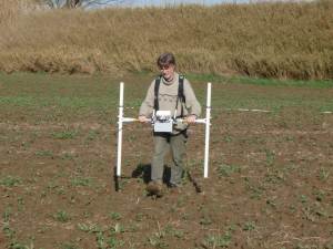
Magnetometry being undertaken at the inner harbour

Magnetometry being undertaken at the inner harbour

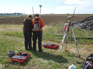
To address these aims the team utilised fluxgate gradiometers, with gridding out and topographic survey conducted using an RTK GPS. Magnetometry was used in a field to the east of the inner harbour of Ephesus, and in fields around the outer harbour and river channel, also on the promontory overlooking the outer harbour.

In addition Electrical Resistivity Tomography (ERT) profiles were conducted at sites along the northern edge of the river channel, across the area of land between the outer harbour and river, and in the area of the floodplain to the north of the inner harbour. These were designed to assess the nature of the deeper sediments associated with the geoarchaeology of the landscape, for comparison with the borehole data collected by the University of Koln.

Although the geophysical survey techniques were deemed appropriate for the conditions of the site, the broad geographical range of the different survey areas,and the potential variations in phasing for the different results, presented the team with a problem; how to recognise the different periods of occupation in these areas, together with an idea of the character and function of many of the structures. To address these issues, fieldwalking was undertaken over each of the survey areas., utilising the grid set out for the geophysics, and using each of the survey markers as the central point for an area of surface material to be collected and recorded within a a 3m radius.


Set out of the survey grid using an RTK GPS

Set out of the survey grid using an RTK GPS


ERT survey to the north of the river channel

ERT survey to the north of the river channel


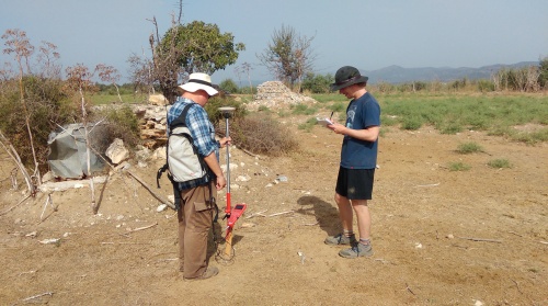
Surface collection to the north of the river channel, using the RTK GPS and note-taking

Surface collection to the north of the river channel, using the RTK GPS and note-taking


The method of sampling allowed collection of all pottery, with a record of presence and absence of CBM (? meaning )and building material. The collection of surface ceramics provides the diagnostic sherds necessary for establishing the type and chronology of the vessels, while its total collection over a small but standard sample area make it possible to calculate the count and weight of sherds and, thus, the potential ceramic density density in each area.

The results of the survey not only provided some excellent information about structures and port infrastructure in the different areas, but also provided some useful spot-dating of the potential phases of occupation of the areas. On the promontory overlooking the outer harbour a number of pit and gully features were found in the geophysical survey results, matching other surface evidence for Archaic settlement pre-dating the Roman harbour. The results of survey to the north and west of the outer harbour indicated large structures associated with the port, dating to the Roman and Late Antique periods. Finally the survey results to the north of the modern river channel detected structures and a possible canal that, when compared to the surface collection, seem to represent Late Roman and Byzantine phases of the port of Ephesus.


Location of surface collection points across the 2015 survey area

Location of surface collection points across the 2015 survey area


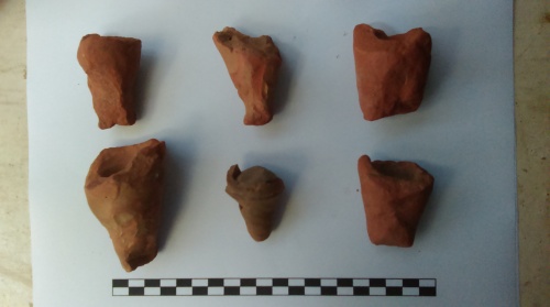
Roman amphora bases located to the west of the outer harbour

Roman amphora bases located to the west of the outer harbour


The results of the season are only preliminary, and further work needs to be undertaken on the data and at the site to fully understand the complexities of the changing harbours of Ephesus. However, a pattern is emerging which seems to indicate a gradual shift in the development of port infrastructure, with activity moving from the inner and outer harbours between the early Roman and Late Antique periods, to a later complex to the north of the modern river between the Late Antique and Byzantine periods. The evidence for pre-Roman occupation in the area is also of interest.

There are obvious caveats about the methodology that we have applied to the site, such as the depth of potential deposits and the nature of material exposed at the surface, which will ultimately affect the dating of material to particular periods of occupation. However, the combined strategy of surface collection and geophysical survey does provide us with a more nuanced data-set than with geophysics on their own, and has already started to raise interesting questions relating to the development and use of this fascinating port complex.

1 Comment

Filed under Uncategorized

Old Sarum Update

For the last few weeks a fair amount of preparation has been undertaken by various members of staff at the University of Southampton for a press release on the fieldwork conducted at Old Sarum (see previous blog post https://kdstrutt.wordpress.com/2014/04/21/in-the-castle-called-seresberi-old-sarum-and-a-new-survey-of-the-inner-and-outer-baileys/). Peter Franklin and colleagues at the press office have worked hard to produce the finished story, and today things finally came together with a bit of a whirlwind of media attention. The finds of the project to date illustrate the potential of non-intrusive archaeological methodologies to elucidate on the archaeology of a particular site or landscape, without harming the material culture and with some strong underlying scientific concepts on which to base  some degree of interpretation and narrative.

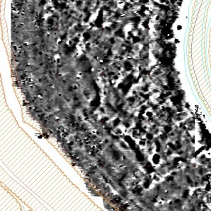
Greyscale image of the magnetometry from the south of the outer bailey (top) and the interpretation plot for the data overlaid on LiDAR for the area (© LiDAR data Environment Agency copyright and/or database right 2014. All rights reserved.)

Greyscale image of the magnetometry from the south of the outer bailey (top) and the interpretation plot for the data overlaid on LiDAR for the area (© LiDAR data Environment Agency copyright and/or database right 2014. All rights reserved.)

The step from geophysical survey data to coherent archaeological narrative is a big one, and one of the reasons that our interpretations to date err on the side of caution. What is apparent from the results is the urban plan of a substantial medieval city, and an array of different forms of structure and associated features in the outer bailey at Old Sarum. Hopefully the results and their wider dissemination at this stage will help to generate interest in the site, the methodology used, and the wider applications of these approaches to archaeological research.

To date the results have been reported in a number of sources. Online the sources include:

BBC News   http://www.bbc.co.uk/news/uk-england-wiltshire-30300837

The Independent   http://www.independent.co.uk/news/science/archaeology/archaeologists-find-vast-medieval-palace-buried-under-prehistoric-fortress-at-old-sarum-9898759.html

The Telegraph   http://www.telegraph.co.uk/earth/environment/archaeology/11269753/Medieval-city-uncovered-by-archaeologists-and-not-a-spade-in-sight.html

More will hopefully follow tomorrow. Above all else the results show the pertinence of student involvement in research-led teaching, from developing an understanding of the archaeological and scientific theory for the work, to dealing with practical aspects of survey and undertaking fieldwork, to being involved in the processing and interpretation of data. The results at Old Sarum are testament to the peerless hard work and dedication of the students on the project, as well as the staff involved in their supervision.

Notes:

For images or for interviews with Kris Strutt, please contact Peter Franklin, Media Relations, University of Southampton. Tel: 023 8059 5457 email: franklin@southampton.ac.uk

For more information about the Archaeological Prospection Service of Southampton (APSS) visit:http://www.southampton.ac.uk/archaeology/research/groups/archaeological_prospection_service_southampton.page


For more about the Old Sarum and Stratford-Sub-Castle Archaeological Survey Project visit: http://www.southampton.ac.uk/archaeology/research/projects/old_sarum_and_stratford_sub_castle.page


For more information about Archaeology at Southampton visit: http://www.southampton.ac.uk/archaeology/index.page

For more information about English Heritage visit: http://www.english-heritage.org.uk/

Through world-leading research and enterprise activities, the University of Southampton connects with businesses to create real-world solutions to global issues. Through its educational offering, it works with partners around the world to offer relevant, flexible education, which trains students for jobs not even thought of. This connectivity is what sets Southampton apart from the rest; we make connections and change the world. http://www.southampton.ac.uk/

http://www.southampton.ac.uk/weareconnected


1 Comment

Filed under Uncategorized

Magnetometer Survey at Basing Common

After the successes of the surveys and excavation at Basing House in 2014, a second season of work is being conducted by the Basing House CAT project (http://basinghouseproject.org/) directed by Nicole and Gareth Beale. Work on the excavation is ongoing, and can be seen on the project blog. In addition to this work, however, further geophysical survey is also being conducted on Basing Common.

Elliot surveying the possible location of the siege camp on Basing Common using a magnetometer, with Basing House within the trees in the background

Elliot surveying the possible location of the siege camp on Basing Common using a magnetometer, with Basing House within the trees in the background

A combination of geophysics and metal detecting is being used over the area to provide information on the location of the Parliamentarian siege camp established in the area during the siege of Basing House. Work started today with Dominic Barker, the author, and a team of students and volunteers. Dom and others involved in the survey will be posting blogs in the coming weeks. However, the survey started well with a grid being established in the southern part of the Common.

Dom Barker gridding out using a GPS

Dom Barker gridding out using a GPS

A small area of magnetometry was covered, however, the results seem to indicate the presence of possible anomalies relating to a possible camp, including a broad ditch feature, a possible bastion, and other more ephemeral ditches and pits. The ploughsoil also indicates ferrous material over the area possibly associated with artefacts from the seige. The plan is to use metal detecting to find artefacts across the survey area, with these being bagged up and located using the GPS, allowing their distribution to be compared with the geophysical survey results. Please check back for further developments over the duration of the field season.


1 Comment

Filed under Uncategorized

Blog Catch-up #1: Archaeology and Survey in the Nile Delta at Naukratis

Due to commitments in the field over the last month or so it has proved difficult to keep up to date with the blog. Now seemed like a good time to produce a few posts to highlight some recent fieldwork and site visits, starting with a recent survey at Naukratis. In May 2014 I conducted geophysical survey at this archaeological site in the Nile Delta. The Naukratis fieldwork project is directed by Ross Thomas of the British Museum, and seeks to assess the surviving archaeology of this important ancient site using a range of complementary methods including topographic and geophysical survey, in addition to borehole survey and excavation, as part of a larger project directed by Alexandra Villing of the Greek and Roman department of the British Museum called ‘Naukratis: Greeks in Egypt’.

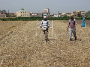
Magnetometer survey being conducted to the east of Kom Ge'if

Magnetometer survey being conducted to the east of Kom Ge’if


The season in May (the third season of fieldwork) added to the existing dataset from the first two seasons in 2013, mapping the extent of the ancient settlement and its association with the Canopic Branch of the River Nile.

The port of Naukratis was the earliest Greek port in Egypt, established in the late 7th century BC as a base for Greek (and Cypriot) traders and the port of the royal Pharaonic city of Sais. It was an important hub for trade and cross-cultural exchange long before the foundation of Alexandria and continued to be significant through the subsequent Ptolemaic, Roman and Byzantine periods. Previous fieldwork was conducted by Flinders Petrie amongst others, and concentrated on excavation of the central areas of the ancient town. Further research was required to fully understand this very important archaeological site. For this season, the magnetometer survey of the site was continued in the fields surrounding the modern village.

Two ERT profiles were also undertaken using an Allied Associates Tigre ERT. The first of the profiles ran from a point some 400m to the west of the site, over the kom or mound, to a point 400m to the east of the site, incorporating the line of the Canopic Branch of the Nile and Naukratis. This provided a section 15m deep running west-east across the southern part of the site. The main aim was to better understand the geological relationship between the river and the settlement, and to tie the profile in with the series of borehole surveys conducted along the same traverse.


Mohamed Roshti assisting with the ERT survey on the kom

Mohamed Roshti assisting with the ERT survey on the kom

The survey work at Naukratis has produced significant new data on the layout of the ancient town, its local environment and hinterland, including the location of the Greek sanctuary complex, the Hellenion, and the Temenos or temple enclosure at the site. The magnetometer results located a large number of mud brick and stone structures in the fields around Kom Ge’if, particularly in the north and east of the site. In addition to the plan of the ancient town, the magnetometer results also give us a much better idea of the extent of the ancient site in relation to the location and development of the Canopic branch of the Nile, which ran to the west of the ancient settlement. The magnetometry clearly shows the change from settlement to canal infilling, with structures positioned along the edge of the canal. This data is reinforced by the results of the ERT survey. The depth of deposits underlying and surrounding Kom Ge’if is suggested by the topography, with a sharp contrast between the kom and the surrounding fields. The remains of the ancient site are present, if buried, but life in the modern village of Kom Ge’if carries on. The village, with its new mosque, stands out from the surrounding floodplain, a mixture of bean fields, and brown ploughed and saturated fields prepared for planting melon. A number of venerable sheikhs’ tombs stand out on the fringes of the village. The local shepherd crosses from field to field, allowing his sheep and goats to graze on the stubble remaining from the wheat harvest, and manuring the fields in the process, then herds the flock back through the winding streets of Kom Ge’if.


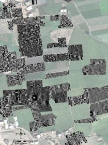
Detail of survey results from Naukratis

Detail of survey results from Naukratis

Many of the areas of the ancient settlement still require surveying using magnetometry, and a combined strategy of ERT survey with drilling of boreholes will provide useful comparative data for particular parts of the site and its hinterland.

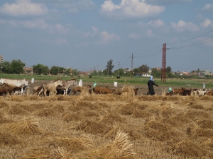
Shepherd leading flock to feed on cut fields

Shepherd leading flock to feed on cut fields

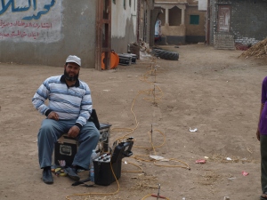
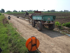
Donkey transport for the ERT

Donkey transport for the ERT


More information on the fieldwork at Naukratis can be found on the project website at: http://www.britishmuseum.org/research/research_projects/all_current_projects/naukratis_the_greeks_in_egypt.aspx

Also, you can discover more about the artefacts recovered from Naukratis by visiting the Online Research Catalogue at:

http://www.britishmuseum.org/research/online_research_catalogues/ng/naukratis_greeks_in_egypt.aspx


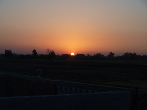
Sunset over Kom Ge'if

Sunset over Kom Ge’if

This post is a reworking of an article recently published in the International Society for Archaeological Prospection (ISAP) Newsletter for May 2014.

1 Comment

Filed under Uncategorized

New Discoveries at Ostia Antica and the Isola Sacra


David Knight undertaking magnetometry in the vicinity of the Tiber levee on the Isola Sacra in 2008

David Knight undertaking magnetometry in the vicinity of the Tiber levee on the Isola Sacra in 2008

The new discovery of extensive urban remains to the north of the river Tiber at Ostia Antica http://www.portusproject.org/blog/2014/04/new-city-wall-discovered-ostia/#.U063XyX5rTc.twitter highlights part of the survey project conducted between 2008 and 2012 across the Isola Sacra, the area of delta between Ostia Antica and Portus. The Isola Sacra, defined by the modern line of the River Tiber to the south and east, the Fossa Traiana to the north, and the Tyrrhenian Sea to the west, covers some 250 hectares, although the prograding nature of the Tiber Delta means that the ancient Roman coastline lies some 1.5km inland from its modern counterpart, reducing the area to 150 hectares.

The Isola has been a relatively unknown area relative to the sites of Portus and Ostia Antica. Although excavation of the Necropolis di Porto in the 1940s revealed the line of the Via Flavia connecting Ostia Antica with Portus, and tombs dating from the 2nd, 3rd and 4th centuries, the ‘sacred island’ has been the focus of scant investigation, beyond archaeological findspots and more recent investigation for mitigation works (see gazetteer in Germoni et al. 2011). Survey work between 2008 and 2012 focused on the production of a high resolution magnetometer survey of the landscape, covering most of the area between the ancient coastline, close to the line of the Via della Scafa, and the Tiber and Fossa Traiana. This survey was not a hunt for possible extensions of urban areas across the Tiber or  the Fossa, but an attempt to understand the formation of this part of the delta in terms of geoarchaeological material, and the settlement and use of the zone, particularly for the Republican and Imperial periods, and the development of both Ostia Antica and Portus.


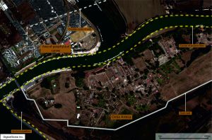
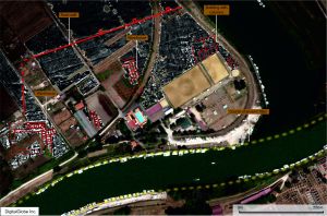
Results of the magnetometer survey in the southern part of the Isola Sacra. Satellite image courtesy of DigitalGlobe

Results of the magnetometer survey in the southern part of the Isola Sacra. Satellite image courtesy of DigitalGlobe

Seven seasons of survey work were conducted over the area, representing a massive effort by staff and students at the University of Southampton, the University of Cambridge and the British School at Rome, directed by Prof. Simon Keay and Prof. Martin Millett. Gridding and topographic survey was conducted with total station and RTK GPS, allowing the entire landscape to be gridded prior to the geophysical survey being conducted. Bartington Instrument fluxgate gradiometers were then used to survey across the landscape, covering an area of 150 hectares, to add to the 260 hectares covered at Portus in previous seasons, picking up on faint variations in the Earth’s magnetic field caused by buried archaeological deposits.

RTK GPS being used to survey in the vicinity of Ostia Antica by the University of Southampton and BSR team

RTK GPS being used to survey in the vicinity of Ostia Antica by the University of Southampton and BSR team

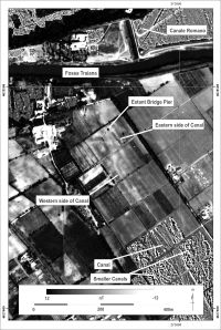
The survey deepened our understanding of the complexity of archaeological deposits across the Isola, indicating the presence of significant waterways and canals associated with Portus and the Isola Sacra, together with a system of smaller canals for drainage and irrigation, or pre-Roman or Roman date. Compared with other data such as satellite imagery, a full assessment of the nature of archaeological features was conducted (Keay, Millett and Strutt 2014). In addition targeted use of geophysical survey methods has elucidated on the presence of archaeological remains, including the presence of Late Antique walls and structures close to the Episcopio near Portus, found during GPR survey in the area.

Image showing magnetometry results superimposed on Aereo Militare image from 1957, showing the presence of the canal traversing the Isola Sacra

Image showing magnetometry results superimposed on Aereo Militare image from 1957, showing the presence of the canal traversing the Isola Sacra (from Keay, Millett and Strutt 2014)


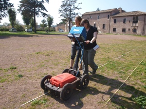
MSc students from the University of Southampton carrying out a GPR survey in the vicinity of the Episcopio, between Portus and the Isola Sacra

MSc students from the University of Southampton carrying out a GPR survey in the vicinity of the Episcopio, between Portus and the Isola Sacra

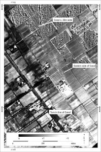
The results of the geophysics shows traces of the formation of the delta in the area of the Isola, including magnetic features associated with the prograding nature of the delta, and previous flow of the Tiber. This is particularly marked on the Isoal close to the Fiume Morto or ancient bend in the Tiber close to Ostia Antica. The significant canal that runs from Portus appears to run all of the way across the Isola, arriving close to the modern east – west course of the Tiber.

The canal visible in the south of the Isola Sacra (from Keay, Millett and Strutt 2014)

The canal visible in the south of the Isola Sacra (from Keay, Millett and Strutt 2014)

It is in this area that the substantial remains of an extension to the town of Ostia was found. The results indicate the presence of warehouses and large municipal buildings, some measuring 140m by 80m in length and breadth. The structures are enclosed by the line of a large defensive wall, with rectangular towers, each measuring 8m across.

Detail from the magnetometer survey results from the southern part of the Isola Sacra

Detail from the magnetometer survey results from the southern part of the Isola Sacra

The findings of the urban area are exciting in their own right. However what is more edifying is the relationship between this area and the surrounding hinterland of this complex port system. Beyond the gates of the city lies a landscape of fluvial and canal features linking the wetland of the delta, with its salt pans, fields and marble marshalling areas, with the River Tiber and the surrounding settlements and farms of the Tiber Delta. The results of the survey present an image of a complex and nuanced port and fluvial system, requiring considerable further analysis to understand the full significance of the delta area in relation to its principal urban areas and the surrounding landscape.


Press Sources

http://www.independent.co.uk/news/science/archaeology/size-matters-crucial-ancient-roman-city-ostia-was-40-bigger-than-previously-thought-after-british-team-uncovers-new-ruins-9265461.html


http://www.telegraph.co.uk/earth/environment/archaeology/10770480/Ancient-Rome-was-bigger-than-previously-thought-archaeologists-find.html

http://www.lastampa.it/2014/04/16/italia/cronache/scoperta-unostia-antica-segreta-era-pi-grande-dellantica-pompei-f0SBt3SkweayIHMqGjmHeO/pagina.html


http://www.leggo.it/NEWS/ROMA/ostia_antica_segreta_pi_amp_ugrave_grande_pompei_foto/notizie/636381.shtml


http://roma.repubblica.it/cronaca/2014/04/16/news/ostia_antica_segreta_pi_grande_pompei-83783253/?ref=HREC1-7


http://video.repubblica.it/edizione/roma/scoperta-ostia-antica-segreta-era-il-doppio-di-pompei/163069/161559?ref=nrct-12

References

Germoni, P., Millett, M., Keay, S. And Strutt, K. 2011, The Isola Sacra: reconstructing the Roman landscape. In Proceedings of the Portus Workshop, March 3rd 2008, Rome.

Keay, S., Millett, M. and Strutt, K. 2014, The Canal System and Tiber Delta at Portus. Assessing the Nature of Man-Made Waterways and their Relationship with the Natural Environment . In Journal of Water History, 6, 1, 11-30.


Leave a comment

Filed under Uncategorized

‘In the castle called Seresberi’. Old Sarum and a New Survey of the Inner and Outer Baileys

John Constable's watercolour of Old Sarum, showing the scale of the outer ramparts and the Norman motte (source: Wikicommons, http://commons.wikimedia.org/wiki/File:John_Constable_-_Old_Sarum_-_WGA5198.jpg)

John Constable’s watercolour of Old Sarum, showing the scale of the outer ramparts and the Norman motte (source: Wikicommons, http://commons.wikimedia.org/wiki/File:John_Constable_-_Old_Sarum_-_WGA5198.jpg)

Old Sarum in Wiltshire has always proved an emotive archaeological site. The substantial ramparts of the Iron Age hillfort and the medieval motte dominate the skyline on the A345 running north from Salisbury, and has been portrayed by scholars and artists including Stukeley and John Constable. The palimpsest of settlement at the site and in its environs encompasses the Iron Age and Romano-British periods, possible Anglo-Saxon settlement, and the medieval founding of a castle, cathedral and settlement. The site formed part of the rotten borough of Old Sarum, and its strategic position was utilised during the Second World War. The Inner and then Outer Bailey formed the focus of excavations in the first part and middle of the 20th century, first by Hawly , Hope and Montgomerie in the years preceeding the First World War, then by Rahtz in the 1940s and 1950s.

The work of Hawley and Hope commenced with excavation of the Inner Bailey in the earlier seasons. Excavation then extended to the Outer Bailey, with the 1914 season focusing on the Cathedral and Bishop’s Palace. The excavation report indicates the presence of structural remains beyond those currently visible at the site, with a number of the lesser structures having been backfilled. The later work by Rahtz focused on the ramparts of the Outer Bailey and the tunnel running through the northern section of the ramparts. The body of work left from the excavations provides ample evidence of the nature and depth of the archaeological deposits for both the Inner and Outer Baileys, although the focal point of the work was always trained on the more substantial or higher status structures and buildings of the site. Much of the urban plan of the Inner Bailey, including the Palace, the Keep and Postern Tower was revealed, although some scintillating glimpses of structures from earlier periods, including a possible Roman building some 5m below the modern ground surface, were also gained. In the Outer Bailey the excavations revealed considerable structures for the cathedral and Bishop’s Palace, but much of the area in the other three quadrants of the Outer Bailey remain a mystery. On the basis of the known archaeological evidence for the site it was decided that application of topographic and geophysical survey techniques would assist in mapping the buried remains across the remainder of the Outer Bailey, and the unexcavated parts of the Inner Bailey.

To that end staff at the University of Southampton drew up a three year project overview, and were granted permission from English Heritage, to carry out a new survey at the site and in its environs as part of student fieldwork for second and third year modules in archaeological survey and geophysical survey. Results of the survey would form the basis for students to compile their own reports for assessment on the modules.

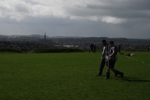
Geophysical survey in the Outer Bailey with the spire of Salisbury Cathedral visible in the background

Geophysical survey in the Outer Bailey with the spire of Salisbury Cathedral visible in the background

The work of the staff and students this year centred on the area within the ramparts of the hillfort, some 6.5 hectares in size, with topographic survey and earth resistance and magnetometry being conducted in the Outer Bailey, and GPR survey across the Inner Bailey to target areas left unexcavated by Hawley and Hope. Survey was supervised by the author, Timothy Sly, Dominic Barker, Penny Copeland and Scott Chaussee.

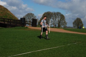
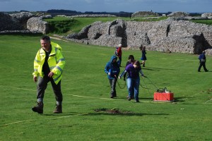
Magnetometer survey in the Outer Bailey with the bridge to the Inner Bailey in the background

Magnetometer survey in the Outer Bailey with the bridge to the Inner Bailey in the background

Earth resistance survey in the Outer Bailey

Earth resistance survey in the Outer Bailey

In spite of the mixed success using magnetometry at some sites in Hampshire and Wiltshire, the nature and depth of deposits at Old Sarum meant that the flint core and stone buildings of the Outer Bailey contrast well to the surrounding sediment. In addition the response to the earth resistance survey was also clear. The preliminary results for the Outer Bailey indicate extensive structures across the entire area, with buildings spread out along the curtain wall, particularly in the south-east sector of the site, and the pattern of urban areas visible in the south-west sector.

Detail of the results of the magnetometry from the Outer Bailey

Detail of the results of the magnetometry from the Outer Bailey

Many of the structures from the Hawley and Hope and Rahtz excavations are also present, and new buildings are added to the plan of the north-west sector of the site, including a possible sub-circular structure.

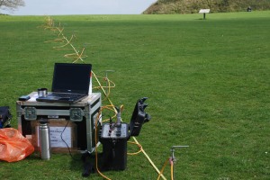
The GPR survey in 2014 focused on the area of the Inner Bailey, utilising a 200MHz antenna, and on targetted areas in the Outer Bailey using a 500MHz antenna. In principle the use of the lower frequency antenna within the Inner Bailey should assist in locating some of the deeply buried structures below the level of medieval buildings mentioned in the literature. Potentially comparison of these results at 5-6m depth should allow a picture of the Iron Age and Roman deposits for the area to be compared with the results from the Outer Bailey.

GPR survey of the Inner Bailey. Many of the excavated structures give a clear indication of the potential depth of some of the deposits, up to c.5m in places. The 200MHz antenna should allow structures to be located down to these depths

GPR survey of the Inner Bailey. Many of the excavated structures give a clear indication of the potential depth of some of the deposits, up to c.5m in places. The 200MHz antenna should allow structures to be located down to these depths

In addition to the high resolution survey work, an Electrical Resistivity Tomography (ERT) profile was run across the site, through the western entrance to the hillfort, skirting the northern side of the motte ditch, and ending close to the ramparts on the north-eastern side of the site. The profile is designed to assess the depth of archaeological sediments across the site, and their relationship to the underlying gravels and chalk.

ERT survey in a profile running across the site

ERT survey in a profile running across the site

There is much work to do for the interpretation of the results, but the correlation between the 20th century excavations and the latest results is telling. The results are allowing the team to expand on the excavation plans, showing the presence and nature of the new structures in all areas of the site, including ranges of buildings on the southern edge of the area of the Cathedral, and a substantial building standing alone in the south-eastern sector of the Outer Bailey. The plan for the next few seasons will be to complete work in the Outer Bailey, and to conduct survey in the environs of Old Sarum. The relationship between the defended site and the Roman road and settlement to the south of the ramparts will provide a focus for research.

9 Comments

Filed under Uncategorized

Archaeological Survey at Ras Al Hadd, Oman

Over the last few weeks a team from the University of Southampton has been working with a team from the British Museum, surveying the archaeological site at Ras Al Hadd. The focus of the survey work was to carry out a topographic survey of the site, and to conduct magnetometer and GPR survey of areas of the occupation mound, prior to the commencement of excavation of the site. In addition the geophysical survey grid was used as the basis for intensive surface collection across the western portion of the site.

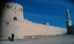
The fort at Ras Al Hadd

The fort at Ras Al Hadd

The Bronze Age and Iron Age archaeology at the site forms a mound on  the coastal plain a few kilometres from the tip of the south-east limits of the Arabian Peninsula. Later settlement has covered most of the site, including a substantial fort and new mosque. The remnants of post-medieval defence overlie the mounds of the later prehistoric settlement, one of a number in the area of the coast. It is the later archaeology that is immediately striking upon visiting Ras Al Hadd. A number of old cannon litter the village, some propped on breeze block plinths, some lying forgotten. Others are located in the fort, and lines of Martini-Henry rifles line the walls of the entrance to the courtyard. In the vicinity of the inlet and lagoon to the west of the site, a solitary tower guards the entrance to the inlet and  the reaches of the lagoon.

The lagoon to the west of Ras Al Hadd

The lagoon to the west of Ras Al Hadd

The focus of the survey was, however, the prehistoric material at Hadd. The survey utilised a number of techniques to map the area. The survey grid was established using RTK GPS, with the instrument also being used to map the topography across the site and the surrounding coastal plain between the mound and lagoon. Surface features were also surveyed in for comparison with the geophysical survey results.

GPS survey under way

GPS survey under way

Phil Riris carrying our magnetometer survey

Phil Riris carrying our magnetometer survey

The site was also surveyed using magnetometry and GPR, focusing on the western and northern parts of the mound,where modern occupation has affected the archaeology the least, and within the interior of the fort. Results of the survey revealed a number of potential archaeological features, including remains of earlier phases of the fort, Iron Age pits, and cairns. In addition to the geophysics, the British Museum team and a team of workmen undertook a systematic surface collection of a part of the surveyed area. The preliminary results show the strength of the methodology incorporating such techniques, with the plot of the fieldwalking overlying on the geophysics, and giving some clear pointers as to the nature of the ancient deposits.

Fieldwalking being carried out along the western side of the mound

Fieldwalking being carried out along the western side of the mound

One of the outcomes of travelling in the area was the opportunity to take a cursory look at the coastal area with a radius of a few kilometres from Hadd. The terrain shows the same plain, covered with thorn scrub and coastal inlets, but with a number of small occupation mounds breaking the topography. Indicating quite a dispersed settlement and use of different sites by the population, from prehistory up until more recent times. An amazing landscapewith hopefully much further scope for work.

1 Comment

Filed under Uncategorized

Basing House Spring Survey – Week 2 Day One

After a few weeks out of the field, the staff and students from the University of Southampton arrived back at Basing House to start the geophysical survey component of the fieldwork. A mix of third year students from Archaeology and Oceanography, Erasmus students and postgraduates headed out to the site. Chris Elmer again gave the group a tour of the site, while supervisors commenced gridding out the site using Smartnet GPS. The group were then divided into teams to carry out magnetometry, resistance survey, GPR and magnetic susceptibility.

Team gridding out the site with the GPS

Team gridding out the site with the GPS

Magnetometry commenced in the area to the west and south of the ringwork and Old House, covering parts of the Civil War defences. Two Bartington Instruments gradiometers were used. The resistivity teams started work in the area of the Outer Bailey, surveying at 0.5m by 0.5m resolution. Continue reading

2 Comments

Filed under Basing House Survey Project

Basing House Survey

Today’s blog from Nicole for the survey at Basing House!

Basing House Project

Today was a cold but very productive day up at Basing House.

The student teams are getting faster at recording topography and have covered huge areas of the site.

Surveying in the limits of the New House has been tricky as there are partial walls to try to identify.

One of the student teams is made up of Masters students, two of whom are planning to use Basing House as the major case study for their dissertation projects. The Masters students were working on surveying the very complex interior of the Old House today. It was out of the wind, but still very cold!

I started a photographic suvey of the various grafitti on the site. The photos below show examples of the variety of graffiti in the Old House etched into the plaster. We’re planning to use some new computational photography techniques to record this in the summer.

There…

View original post 597 more words

Leave a comment

Filed under Basing House Survey Project

End of another week of magnetometry and topographic survey

Another week of survey at Antinoupolis is at an end. This week work focused on survey in the area of the ancient city, between the northern corner of the walls and the east gate survey area from 2012. In addition Jay has spent the last few days starting a GPS topographic survey of the east gate and the hippodrome to the north-east of the city. Continue reading

Leave a comment

Filed under The Antinoupolis Project