Tag Archives: GPR

The Portuslimen Project. Geophysical survey at Tarragona, and the constraints of modern urban areas

Over the past few months of field survey, work has swung around to a series of projects lined to Roman ports in the Mediterranean. In June and July I headed back for a season of excavations at Portus, and in August and September geophysical survey at the site of Ephesus in Turkey (more on this in a future post). In October and November work has commenced on a geophysical and topographic survey of the Roman port area of the town of Tarragona in Catalonia, Spain. The work, together with that of Ephesus, forms part of the Roman Meditteranean Ports (RoMP) project, or Portuslimen (http://portuslimen.eu/). A component of this project involves the survey of a number of port sites, to understand the form and extent of these sites, and help analyse the ways in which they may have functioned through time. The work at Tarragona is being conducted in collaboration with colleagues from l’Institut Català d’Arqueologia Clàssica (ICAC).


The modern port of Tarragona, with its harbour, docks and factories

The issue with Tarragona is that the development of the town and port spans from the pre-Roman period, to the establishment of the Roman town in the third century BC, to Late Roman and Visigothic settlement in the 6th, 7th and 8th centuries, and later Islamic influence. Over this time the town and its port expanded and contracted, and archaeological deposits were buried under fluvial deposits from the Francolí river to the west of the port. Later post-medieval expansion of the town, particularly in the 19th and 20th centuries saw much of the Roman and later port built over, and a new harbour constructed over the remains of the ancient port. The aim of our survey is to attempt to locate significant structural remins of the Roman port and harbour through intrusive methods. The good news is that a number of areas in the city have been excavated in the past 40 years, which helps in the location of the survey to gain as much as possible from the efforts. The bad news is that, due to the modern town plan, many of the survey areas are constrained by modern buildings and infrastructure. Thus our work has to use some specific techniques to conduct survey in the areas that are available. This includes topographic survey and location of survey grids using RTK GPS and total station survey, and use of GPR and ERT along streets and in plazas to map buried remains.

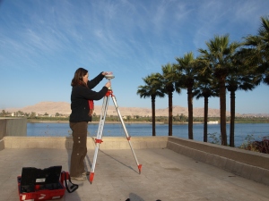
Set up of the GPS and GPR by the University of Southampton team in the Placa dels Carros

Set up of the GPS and GPR by the University of Southampton team in the Placa dels Carros


The GPS base station collecting static data for the survey

The GPS base station collecting static data for the survey


Fortunately for the University of Southampton team, the open plazas of the town provided sufficient space for static data to be collected by the GPS base station, and for a series of preliminary stations to be established using the GPS. Where the streets became narrow a total station was used to establish further stations in a traverse around the port area of the town.

Geophysical survey s far has focused on 500MHz GPR, propagating 3-4m below the modern street level to find the buried archaeology. In some of the streets in the northern part of the port area, particularly along the roads close to the Roman baths and theatre a number of walls and other features are visible. As the survey progresses southwards, however, modern infrasructure such as manhole covers, and the nature of the made-up ground close  to the modern harbour, make the results more difficult to interpret. The restrictions in terms of spatial coverage have also provided a challenge in terms of data interpretation.

Total station survey in one of the streets of Tarragona

Total station survey in one of the streets of Tarragona


500MHz GPR survey in one of the plazas

500MHz GPR survey in one of the plazas


To better understand the geoarchaeology of the site we have been applying Electrical Resistivity Tomography (ERT) to record both archaeology and deeper deposits in the town. The main constraint with this is that the paved areas of the town preclude the use of survey probes (these cannot be dug through cement and Tarmac). Thus we have had to adapt using a system of electrode copper conductors and a conductive gel. Most surfaces will allow an electrical current to be passed through them, but asphalt and Tarmac act as insulators, meaning that for the ERT to work long stretches of cement pavement need to be surveyed.

A conductor formed from crocodile clips, wire and pipe end copper usually used for plumbing.

A conductor formed from crocodile clips, wire and pipe end copper usually used for plumbing.

The ERT profile being conducted adjacent to the Roman theatre

The ERT profile being conducted adjacent to the Roman theatre


In spite of our initial misgivings, the conductors and gel, with the ERT equipment, have proved to work very well indeed. The profile alongside the Roman theatre has revealed a number of areas of walls and rubble aligned adjacent to the excavated theatre remains. The team hope to conduct a long profile of ERT in the southern part of the modern port which, together with the boreholes of Ferreol Salomon, will investigate the nature of the harbour deposits.

The survey work is being conducted until 15th November, and there are many features of the topography of the ancient harbour that remain to be discovered, including the line of the Roman seafront and mole.

The bay to the east of the port

The bay to the east of the port


Leave a comment

Filed under Uncategorized

Between the Desert and the Nile. Theban Harbours and Waterscapes

The West Bank of Thebes

The West Bank of Thebes

Back in 2011 the Theban Harbours and Waterscapes Survey (THaWS) started with a field season of geophysics. This Egypt Exploration Society project (www.ees.ac.uk), directed by Dr Angus Graham,  was established with the aim of using different techniques to study the settlements and temples on the east and west banks of the Nile, and how they relate to the changing floodplain and river. Unfortunately the season had to be aborted after the 25th January revolution, and the survey was postponed to the 2012 season, when the fieldwork progressed at a cracking pace.

After five years of the project a large quantity of survey data, together with sedimentary data from auger samples, has been collected and is pushing forward some tentative interpretations about the archaeology and geomorphology of the area. Fieldwork in areas as diverse as Malqata, Birket Habu and the floodplain in front of Kom El Hetan and the Ramesseum has provided food for thought on the depth of ancient ground levels and the organisation of the waterways on the West Bank, with interesting results from some of the East Bank work, including Karnak.

For the 2015 season the fieldwork has shifted up a notch with a larger and more diverse team. The plan was to run different geophysical survey techniques, while also continuing the auger sample strategy and processing of samples from the 2014 and 2015 seasons. Work has very much focused on Electrical Resistivity Tomography (ERT) surveys on the West Bank, particularly in the area to the east of the Ramesseum heading up to the current course of the Nile, with Ginger Emery working on the instrument. This has been complemented by an intensive season of auger work conducted by Ben Pennington and Willem Toonen, to investigate changes in the sediments represented in the ERT.

ERT survey under way on the West Bank

ERT survey under way on the West Bank

Auger work along ERT profile 32, West Bank

Auger work along ERT profile 32, West Bank

The survey has allowed a solid dataset to be collected running from c.600m to the east of the Ramesseum all the way the the modern banks of the Nile, with the resistivity and auger data integrating to allow some more nuanced interpretations of the development of the floodplain and the presence of possible man-made canals to be ascertained. The work in this area relates closely to the function of temples further to the south between the Birket Habu and the Ramesseum.

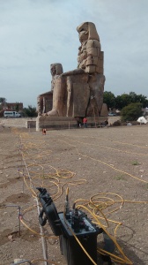
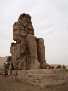
ERT profile running at the foot of the Colossi of Memnon, Kom El Hetan

ERT profile running at the foot of the Colossi of Memnon, Kom El Hetan

This week we have focused the work in the area of Kom El Hetan. Previous seasons provided information on the axis of theTemple of Amenhotep and the possible presence of channels associated with the temple. The aim this week has been to expand on this information with more intensive ERT and Ground Penetrating Radar (GPR) survey in the area.

ERT survey at Kom El Hetan

ERT survey at Kom El Hetan

Hopefully by the end of the week we will have a series of close (5m) profiles of ERT data to model, and GPR data at 0.5m intervals across the front of the Colossi, in the first court, and in the third court for comparison, with a second plan to conduct more GPR profiles in the fields to the south to detect the possible enclosure of the temple. It promises to be an exciting week.

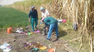
There have been trials and tribulations in the fieldwork, including negotiations with landowners, and issues with the burning of sugar cane chaff during the first two weeks. There have also been compensations, not least in the form of tea and cake, the latter being provided by the wife of Sumara, one of our workmen.

Burning sugar cane chaff promises to engulf the ERT equipment

Burning sugar cane chaff promises to engulf the ERT equipment

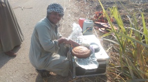
Husam cuts the cake provided by Sumara's wife. One of the perks of fieldwork in Egypt!

Husam cuts the cake provided by Sumara’s wife. One of the perks of fieldwork in Egypt!

The fieldwork will be carrying on at Thebes until 1st April. However, results from the previous seasons of work are presented in the last three editions of the Journal of Egyptian Archaeology, and in other papers listed below. Happy reading!


Graham, A. and Strutt, K. 2012, The Theban Harbours and Waterscapes Survey. Recent Fieldwork to Investigate the Canals and Harbours on the West and East Banks at Ancient Thebes (Luxor), Egypt. The Newsletter of the International Society for Archaeological Prospection 31, April 2012, 6-7.

Graham,A., Strutt, K., Hunter, M., Jones, S., Masson, A., Millett, M., Pennington, B. 2012, Reconstructing Landscapes and Waterscapes in Thebes, Egypt. In Journal for Ancient Studies eTopoi, 3, 135-142.

Graham, A., Strutt, K.D., Hunter, M. , Jones, S., Masson, A., Millet, M., and Pennington, B.T. 2012, Theban Harbours and Waterscapes Survey, 2012. Journal of Egyptian Archaeology 98, 27-42.

Graham, A. and Strutt, K. 2013, Ancient Theban Temple and Palace Landscapes. In Egyptian Archaeology 43, Autumn 2013, 5-7.

Graham, A, Strutt, K., Emery, V.L., Jones, S. and Barker, D. 2014, Theban Harbours and Waterscapes Survey, 2013. The Journal of Egyptian Archaeology 99, 35-52.

Graham, A. and Strutt, K. (forthcoming), Ancient Theban Temple and Palace Landscapes. Egyptian Archaeology. Journal of Egyptian Archaeology 100.

Leave a comment

Filed under Theban Harbours and Waterscapes Survey

Old Sarum Update

For the last few weeks a fair amount of preparation has been undertaken by various members of staff at the University of Southampton for a press release on the fieldwork conducted at Old Sarum (see previous blog post https://kdstrutt.wordpress.com/2014/04/21/in-the-castle-called-seresberi-old-sarum-and-a-new-survey-of-the-inner-and-outer-baileys/). Peter Franklin and colleagues at the press office have worked hard to produce the finished story, and today things finally came together with a bit of a whirlwind of media attention. The finds of the project to date illustrate the potential of non-intrusive archaeological methodologies to elucidate on the archaeology of a particular site or landscape, without harming the material culture and with some strong underlying scientific concepts on which to base  some degree of interpretation and narrative.

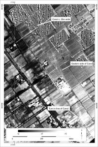
Greyscale image of the magnetometry from the south of the outer bailey (top) and the interpretation plot for the data overlaid on LiDAR for the area (© LiDAR data Environment Agency copyright and/or database right 2014. All rights reserved.)

Greyscale image of the magnetometry from the south of the outer bailey (top) and the interpretation plot for the data overlaid on LiDAR for the area (© LiDAR data Environment Agency copyright and/or database right 2014. All rights reserved.)

The step from geophysical survey data to coherent archaeological narrative is a big one, and one of the reasons that our interpretations to date err on the side of caution. What is apparent from the results is the urban plan of a substantial medieval city, and an array of different forms of structure and associated features in the outer bailey at Old Sarum. Hopefully the results and their wider dissemination at this stage will help to generate interest in the site, the methodology used, and the wider applications of these approaches to archaeological research.

To date the results have been reported in a number of sources. Online the sources include:

BBC News   http://www.bbc.co.uk/news/uk-england-wiltshire-30300837

The Independent   http://www.independent.co.uk/news/science/archaeology/archaeologists-find-vast-medieval-palace-buried-under-prehistoric-fortress-at-old-sarum-9898759.html

The Telegraph   http://www.telegraph.co.uk/earth/environment/archaeology/11269753/Medieval-city-uncovered-by-archaeologists-and-not-a-spade-in-sight.html

More will hopefully follow tomorrow. Above all else the results show the pertinence of student involvement in research-led teaching, from developing an understanding of the archaeological and scientific theory for the work, to dealing with practical aspects of survey and undertaking fieldwork, to being involved in the processing and interpretation of data. The results at Old Sarum are testament to the peerless hard work and dedication of the students on the project, as well as the staff involved in their supervision.

Notes:

For images or for interviews with Kris Strutt, please contact Peter Franklin, Media Relations, University of Southampton. Tel: 023 8059 5457 email: franklin@southampton.ac.uk

For more information about the Archaeological Prospection Service of Southampton (APSS) visit:http://www.southampton.ac.uk/archaeology/research/groups/archaeological_prospection_service_southampton.page


For more about the Old Sarum and Stratford-Sub-Castle Archaeological Survey Project visit: http://www.southampton.ac.uk/archaeology/research/projects/old_sarum_and_stratford_sub_castle.page


For more information about Archaeology at Southampton visit: http://www.southampton.ac.uk/archaeology/index.page

For more information about English Heritage visit: http://www.english-heritage.org.uk/

Through world-leading research and enterprise activities, the University of Southampton connects with businesses to create real-world solutions to global issues. Through its educational offering, it works with partners around the world to offer relevant, flexible education, which trains students for jobs not even thought of. This connectivity is what sets Southampton apart from the rest; we make connections and change the world. http://www.southampton.ac.uk/

http://www.southampton.ac.uk/weareconnected


1 Comment

Filed under Uncategorized

New Discoveries at Ostia Antica and the Isola Sacra


David Knight undertaking magnetometry in the vicinity of the Tiber levee on the Isola Sacra in 2008

David Knight undertaking magnetometry in the vicinity of the Tiber levee on the Isola Sacra in 2008

The new discovery of extensive urban remains to the north of the river Tiber at Ostia Antica http://www.portusproject.org/blog/2014/04/new-city-wall-discovered-ostia/#.U063XyX5rTc.twitter highlights part of the survey project conducted between 2008 and 2012 across the Isola Sacra, the area of delta between Ostia Antica and Portus. The Isola Sacra, defined by the modern line of the River Tiber to the south and east, the Fossa Traiana to the north, and the Tyrrhenian Sea to the west, covers some 250 hectares, although the prograding nature of the Tiber Delta means that the ancient Roman coastline lies some 1.5km inland from its modern counterpart, reducing the area to 150 hectares.

The Isola has been a relatively unknown area relative to the sites of Portus and Ostia Antica. Although excavation of the Necropolis di Porto in the 1940s revealed the line of the Via Flavia connecting Ostia Antica with Portus, and tombs dating from the 2nd, 3rd and 4th centuries, the ‘sacred island’ has been the focus of scant investigation, beyond archaeological findspots and more recent investigation for mitigation works (see gazetteer in Germoni et al. 2011). Survey work between 2008 and 2012 focused on the production of a high resolution magnetometer survey of the landscape, covering most of the area between the ancient coastline, close to the line of the Via della Scafa, and the Tiber and Fossa Traiana. This survey was not a hunt for possible extensions of urban areas across the Tiber or  the Fossa, but an attempt to understand the formation of this part of the delta in terms of geoarchaeological material, and the settlement and use of the zone, particularly for the Republican and Imperial periods, and the development of both Ostia Antica and Portus.


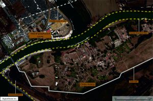
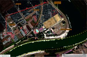
Results of the magnetometer survey in the southern part of the Isola Sacra. Satellite image courtesy of DigitalGlobe

Results of the magnetometer survey in the southern part of the Isola Sacra. Satellite image courtesy of DigitalGlobe

Seven seasons of survey work were conducted over the area, representing a massive effort by staff and students at the University of Southampton, the University of Cambridge and the British School at Rome, directed by Prof. Simon Keay and Prof. Martin Millett. Gridding and topographic survey was conducted with total station and RTK GPS, allowing the entire landscape to be gridded prior to the geophysical survey being conducted. Bartington Instrument fluxgate gradiometers were then used to survey across the landscape, covering an area of 150 hectares, to add to the 260 hectares covered at Portus in previous seasons, picking up on faint variations in the Earth’s magnetic field caused by buried archaeological deposits.

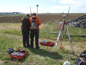
RTK GPS being used to survey in the vicinity of Ostia Antica by the University of Southampton and BSR team

RTK GPS being used to survey in the vicinity of Ostia Antica by the University of Southampton and BSR team

The survey deepened our understanding of the complexity of archaeological deposits across the Isola, indicating the presence of significant waterways and canals associated with Portus and the Isola Sacra, together with a system of smaller canals for drainage and irrigation, or pre-Roman or Roman date. Compared with other data such as satellite imagery, a full assessment of the nature of archaeological features was conducted (Keay, Millett and Strutt 2014). In addition targeted use of geophysical survey methods has elucidated on the presence of archaeological remains, including the presence of Late Antique walls and structures close to the Episcopio near Portus, found during GPR survey in the area.

Image showing magnetometry results superimposed on Aereo Militare image from 1957, showing the presence of the canal traversing the Isola Sacra

Image showing magnetometry results superimposed on Aereo Militare image from 1957, showing the presence of the canal traversing the Isola Sacra (from Keay, Millett and Strutt 2014)


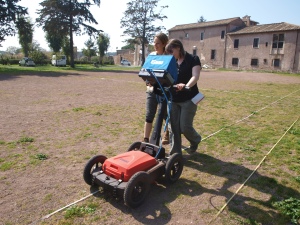
MSc students from the University of Southampton carrying out a GPR survey in the vicinity of the Episcopio, between Portus and the Isola Sacra

MSc students from the University of Southampton carrying out a GPR survey in the vicinity of the Episcopio, between Portus and the Isola Sacra

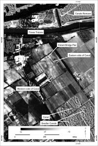
The results of the geophysics shows traces of the formation of the delta in the area of the Isola, including magnetic features associated with the prograding nature of the delta, and previous flow of the Tiber. This is particularly marked on the Isoal close to the Fiume Morto or ancient bend in the Tiber close to Ostia Antica. The significant canal that runs from Portus appears to run all of the way across the Isola, arriving close to the modern east – west course of the Tiber.

The canal visible in the south of the Isola Sacra (from Keay, Millett and Strutt 2014)

The canal visible in the south of the Isola Sacra (from Keay, Millett and Strutt 2014)

It is in this area that the substantial remains of an extension to the town of Ostia was found. The results indicate the presence of warehouses and large municipal buildings, some measuring 140m by 80m in length and breadth. The structures are enclosed by the line of a large defensive wall, with rectangular towers, each measuring 8m across.

Detail from the magnetometer survey results from the southern part of the Isola Sacra

Detail from the magnetometer survey results from the southern part of the Isola Sacra

The findings of the urban area are exciting in their own right. However what is more edifying is the relationship between this area and the surrounding hinterland of this complex port system. Beyond the gates of the city lies a landscape of fluvial and canal features linking the wetland of the delta, with its salt pans, fields and marble marshalling areas, with the River Tiber and the surrounding settlements and farms of the Tiber Delta. The results of the survey present an image of a complex and nuanced port and fluvial system, requiring considerable further analysis to understand the full significance of the delta area in relation to its principal urban areas and the surrounding landscape.


Press Sources

http://www.independent.co.uk/news/science/archaeology/size-matters-crucial-ancient-roman-city-ostia-was-40-bigger-than-previously-thought-after-british-team-uncovers-new-ruins-9265461.html


http://www.telegraph.co.uk/earth/environment/archaeology/10770480/Ancient-Rome-was-bigger-than-previously-thought-archaeologists-find.html

http://www.lastampa.it/2014/04/16/italia/cronache/scoperta-unostia-antica-segreta-era-pi-grande-dellantica-pompei-f0SBt3SkweayIHMqGjmHeO/pagina.html


http://www.leggo.it/NEWS/ROMA/ostia_antica_segreta_pi_amp_ugrave_grande_pompei_foto/notizie/636381.shtml


http://roma.repubblica.it/cronaca/2014/04/16/news/ostia_antica_segreta_pi_grande_pompei-83783253/?ref=HREC1-7


http://video.repubblica.it/edizione/roma/scoperta-ostia-antica-segreta-era-il-doppio-di-pompei/163069/161559?ref=nrct-12

References

Germoni, P., Millett, M., Keay, S. And Strutt, K. 2011, The Isola Sacra: reconstructing the Roman landscape. In Proceedings of the Portus Workshop, March 3rd 2008, Rome.

Keay, S., Millett, M. and Strutt, K. 2014, The Canal System and Tiber Delta at Portus. Assessing the Nature of Man-Made Waterways and their Relationship with the Natural Environment . In Journal of Water History, 6, 1, 11-30.


Leave a comment

Filed under Uncategorized

Archaeological Survey at Ras Al Hadd, Oman

Over the last few weeks a team from the University of Southampton has been working with a team from the British Museum, surveying the archaeological site at Ras Al Hadd. The focus of the survey work was to carry out a topographic survey of the site, and to conduct magnetometer and GPR survey of areas of the occupation mound, prior to the commencement of excavation of the site. In addition the geophysical survey grid was used as the basis for intensive surface collection across the western portion of the site.

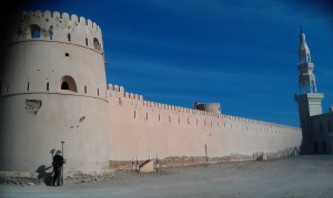
The fort at Ras Al Hadd

The fort at Ras Al Hadd

The Bronze Age and Iron Age archaeology at the site forms a mound on  the coastal plain a few kilometres from the tip of the south-east limits of the Arabian Peninsula. Later settlement has covered most of the site, including a substantial fort and new mosque. The remnants of post-medieval defence overlie the mounds of the later prehistoric settlement, one of a number in the area of the coast. It is the later archaeology that is immediately striking upon visiting Ras Al Hadd. A number of old cannon litter the village, some propped on breeze block plinths, some lying forgotten. Others are located in the fort, and lines of Martini-Henry rifles line the walls of the entrance to the courtyard. In the vicinity of the inlet and lagoon to the west of the site, a solitary tower guards the entrance to the inlet and  the reaches of the lagoon.

The lagoon to the west of Ras Al Hadd

The lagoon to the west of Ras Al Hadd

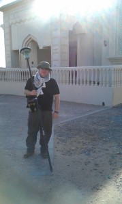
The focus of the survey was, however, the prehistoric material at Hadd. The survey utilised a number of techniques to map the area. The survey grid was established using RTK GPS, with the instrument also being used to map the topography across the site and the surrounding coastal plain between the mound and lagoon. Surface features were also surveyed in for comparison with the geophysical survey results.

GPS survey under way

GPS survey under way

Phil Riris carrying our magnetometer survey

Phil Riris carrying our magnetometer survey

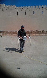
The site was also surveyed using magnetometry and GPR, focusing on the western and northern parts of the mound,where modern occupation has affected the archaeology the least, and within the interior of the fort. Results of the survey revealed a number of potential archaeological features, including remains of earlier phases of the fort, Iron Age pits, and cairns. In addition to the geophysics, the British Museum team and a team of workmen undertook a systematic surface collection of a part of the surveyed area. The preliminary results show the strength of the methodology incorporating such techniques, with the plot of the fieldwalking overlying on the geophysics, and giving some clear pointers as to the nature of the ancient deposits.

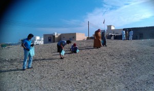
Fieldwalking being carried out along the western side of the mound

Fieldwalking being carried out along the western side of the mound

One of the outcomes of travelling in the area was the opportunity to take a cursory look at the coastal area with a radius of a few kilometres from Hadd. The terrain shows the same plain, covered with thorn scrub and coastal inlets, but with a number of small occupation mounds breaking the topography. Indicating quite a dispersed settlement and use of different sites by the population, from prehistory up until more recent times. An amazing landscapewith hopefully much further scope for work.

1 Comment

Filed under Uncategorized

Basing House Spring Survey – Week 2 Day One

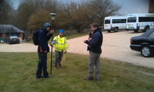
After a few weeks out of the field, the staff and students from the University of Southampton arrived back at Basing House to start the geophysical survey component of the fieldwork. A mix of third year students from Archaeology and Oceanography, Erasmus students and postgraduates headed out to the site. Chris Elmer again gave the group a tour of the site, while supervisors commenced gridding out the site using Smartnet GPS. The group were then divided into teams to carry out magnetometry, resistance survey, GPR and magnetic susceptibility.

Team gridding out the site with the GPS

Team gridding out the site with the GPS

Magnetometry commenced in the area to the west and south of the ringwork and Old House, covering parts of the Civil War defences. Two Bartington Instruments gradiometers were used. The resistivity teams started work in the area of the Outer Bailey, surveying at 0.5m by 0.5m resolution. Continue reading

2 Comments

Filed under Basing House Survey Project

Basing House Survey

Today’s blog from Nicole for the survey at Basing House!

Basing House Project

Today was a cold but very productive day up at Basing House.

The student teams are getting faster at recording topography and have covered huge areas of the site.

Surveying in the limits of the New House has been tricky as there are partial walls to try to identify.

One of the student teams is made up of Masters students, two of whom are planning to use Basing House as the major case study for their dissertation projects. The Masters students were working on surveying the very complex interior of the Old House today. It was out of the wind, but still very cold!

I started a photographic suvey of the various grafitti on the site. The photos below show examples of the variety of graffiti in the Old House etched into the plaster. We’re planning to use some new computational photography techniques to record this in the summer.

There…

View original post 597 more words

Leave a comment

Filed under Basing House Survey Project

Geophysics at Karnak – Intensive GPR survey and the beginning of the end of the survey

The latest work on the THaWS project has been marked by the intensity of survey profiles and survey areas covered, and  the fact that the team have been working almost exclusively in and around Karnak temple. The transition of the GPS survey from the West to the East Bank went smoothly, as reported in the last post. We established a base station on the roof of Chicago House on the West Bank, with the very kind permission of the staff. Some wonderful views were visible across the Nile to the banana plantation and desert edge on the West Bank, andthe set-out made survey convenient for the work at Karnak.

Sarah setting up the base station

Sarah setting up the base station

Continue reading

1 Comment

Filed under Theban Harbours and Waterscapes Survey

Day Two at Kom el Hetan

More area to survey today behind the Colossi of Memnon on the West Bank. We started the day one person down, as Dom’s insides are still rumbling, possibly due to the Egyptian cuisine.  He stayed in to do some office work, and the rest headed out to cross the Nile. We continued the GPR survey behind the Colossi of Memnon, and ran two ERT profiles in front of the same. In addition Sarah’s search for survey stations from previous years continued with the GPS rover. She managed to find most points located between Kom el Hetan and the temple of Merenptah, and completed the morning surveying the bases of the Colossi for comparison with the survey data.

Sarah surveying in the north Colossus

Sarah surveying in the north Colossus

Continue reading

Leave a comment

Filed under Theban Harbours and Waterscapes Survey

THaWS Project – Start of the week survey at Kom el Hetan

The start of another busy week in Thebes and the team headed back to the West Bank to commence GPR and ERT survey in the vicinity of Kom El Hetan and the Colossi of Memnon. The bus stopped however for a short visit to the impressive brickworks on the east bank to the south of Luxor. A massive chimney and a series of arched entrances leading to the kilns mark the site on the banks of the Nile.

Chimney at the brickworks

Chimney at the brickworks

Staircase on western curved side of the brickwork kilns

Staircase on western curved side of the brickwork kilns

In addition to the main double row of kiln entrances and the office building, a set of mudbrick stairs run up to the terrace of the kilns. A great little industrial site in some disrepair, and a diversion to the main tasks of the day on the West Bank. Continue reading

Leave a comment

Filed under Theban Harbours and Waterscapes Survey